
El Puerto topographic map
Interactive map
Click on the map to display elevation.
About this map
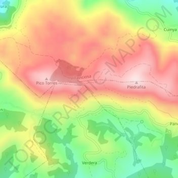
Name: El Puerto topographic map, elevation, terrain.
Location: El Puerto, Cabranes, Asturias, Spain (43.40436 -5.49796 43.42436 -5.47796)
Average elevation: 1,355 ft
Minimum elevation: 715 ft
Maximum elevation: 1,890 ft
Other topographic maps
Click on a map to view its topography, its elevation and its terrain.
Piedrafita
Piedrafita, Cabranes, Asturias, Spain
Average elevation: 1,319 ft