
揭阳市 topographic map
Interactive map
Click on the map to display elevation.
About this map
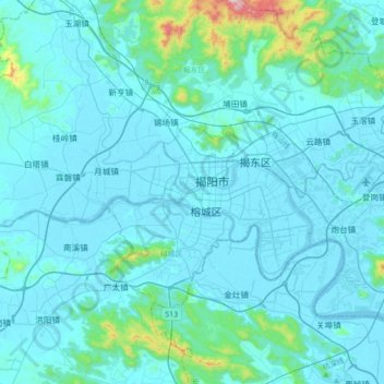
Name: 揭阳市 topographic map, elevation, terrain.
Location: 揭阳市, 榕城区 (Rongcheng), 揭阳市, Guangdong, China (23.38308 116.18972 23.70308 116.50972)
Average elevation: 184 ft
Minimum elevation: -7 ft
Maximum elevation: 2,398 ft