Make a donation
Gear up for your next adventure:
As an Amazon Associate, this site earns from qualifying purchases at no extra cost to you.
Dankaur topographic map
Click on the map to display elevation.
Make a donation
Gear up for your next adventure:
As an Amazon Associate, this site earns from qualifying purchases at no extra cost to you.
About this map
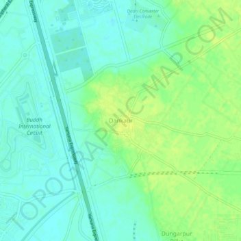
Name: Dankaur topographic map, elevation, terrain.
Location: Dankaur, Gautam Buddha Nagar, Uttar Pradesh, 203200, India (28.33017 77.53331 28.37017 77.57331)
Average elevation: 646 ft
Minimum elevation: 623 ft
Maximum elevation: 673 ft
Make a donation
Gear up for your next adventure:
As an Amazon Associate, this site earns from qualifying purchases at no extra cost to you.
Other topographic maps
Click on a map to view its topography, its elevation and its terrain.
Noida Authority Park
India > Uttar Pradesh > Gautam Buddha Nagar > Noida > Garhi
Average elevation: 650 ft
Make a donation
Gear up for your next adventure:
As an Amazon Associate, this site earns from qualifying purchases at no extra cost to you.
