
Сысерть topographic map
Interactive map
Click on the map to display elevation.
About this map
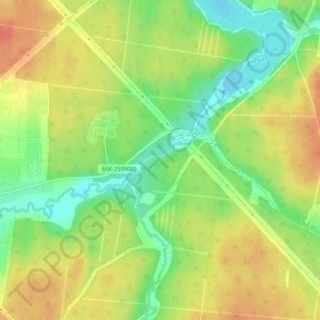
Name: Сысерть topographic map, elevation, terrain.
Average elevation: 833 ft
Minimum elevation: 748 ft
Maximum elevation: 909 ft
Other topographic maps
Click on a map to view its topography, its elevation and its terrain.
Sysert
Russia > Sverdlovsk Oblast > Sysertsky District
Sysert, Sysertsky District, Sverdlovsk Oblast, Ural Federal District, Russia
Average elevation: 833 ft