
El Pilón topographic map
Interactive map
Click on the map to display elevation.
About this map
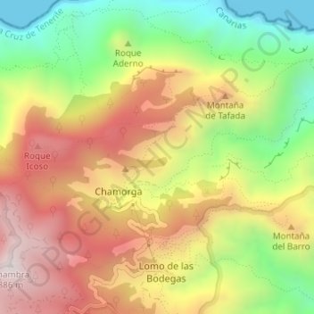
Name: El Pilón topographic map, elevation, terrain.
Location: El Pilón, Santa Cruz de Tenerife, Canarias, 38125, España (28.57249 -16.15885 28.57333 -16.15188)
Average elevation: 1,417 ft
Minimum elevation: 0 ft
Maximum elevation: 2,789 ft
Other topographic maps
Click on a map to view its topography, its elevation and its terrain.
Santa Cruz de Tenerife
España > Canarias > Santa Cruz de Tenerife
Santa Cruz de Tenerife, Canarias, España
Average elevation: 794 ft
El Rincón
España > Canarias > Santa Cruz de Tenerife
El Rincón, Santa Cruz de Tenerife, Canarias, España
Average elevation: 1,122 ft