
Roodeplaat Dam topographic map
Interactive map
Click on the map to display elevation.
About this map
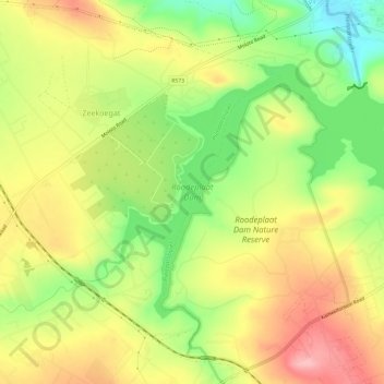
Name: Roodeplaat Dam topographic map, elevation, terrain.
Average elevation: 4,068 ft
Minimum elevation: 3,816 ft
Maximum elevation: 4,308 ft
Other topographic maps
Click on a map to view its topography, its elevation and its terrain.
Tshwane Ward 85
Tshwane Ward 85, Pretoria, City of Tshwane Metropolitan Municipality, Gauteng, RSA
Average elevation: 4,564 ft
Tshwane Ward 77
Tshwane Ward 77, Pretoria, City of Tshwane Metropolitan Municipality, Gauteng, RSA
Average elevation: 4,928 ft
Tshwane Ward 46
Tshwane Ward 46, Pretoria, City of Tshwane Metropolitan Municipality, Gauteng, RSA
Average elevation: 4,580 ft