
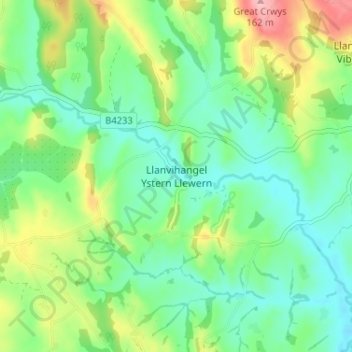
Llanvihangel Ystern Llewern topographic map
Interactive map
Click on the map to display elevation.
About this map
Name: Llanvihangel Ystern Llewern topographic map, elevation, terrain.
Average elevation: 243 ft
Minimum elevation: 105 ft
Maximum elevation: 535 ft
Other topographic maps
Click on a map to view its topography, its elevation and its terrain.
Penrhos
United Kingdom > Wales > Monmouthshire
Penrhos, Monmouthshire, Wales, NP15 2LG, United Kingdom
Average elevation: 259 ft
Trellech
United Kingdom > Wales > Monmouthshire
Trellech, Monmouthshire, Wales, NP25 4NY, United Kingdom
Average elevation: 712 ft