
Neumarkt im Mühlkreis topographic map
Interactive map
Click on the map to display elevation.
About this map
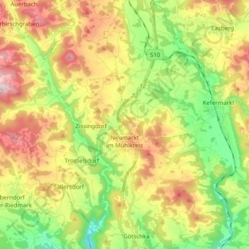
Name: Neumarkt im Mühlkreis topographic map, elevation, terrain.
Average elevation: 1,893 ft
Minimum elevation: 1,230 ft
Maximum elevation: 2,743 ft
Other topographic maps
Click on a map to view its topography, its elevation and its terrain.
Prandegg
Austria > Upper Austria > Bezirk Freistadt > Schönau im Mühlkreis > Prandegg
Prandegg, Schönau im Mühlkreis, Bezirk Freistadt, Upper Austria, 4274, Austria
Average elevation: 2,057 ft
Unterweitersdorf
Austria > Upper Austria > Bezirk Freistadt > Unterweitersdorf
Unterweitersdorf, Bezirk Freistadt, Upper Austria, 4213, Austria
Average elevation: 1,394 ft