
Orchard Hills topographic map
Interactive map
Click on the map to display elevation.
About this map
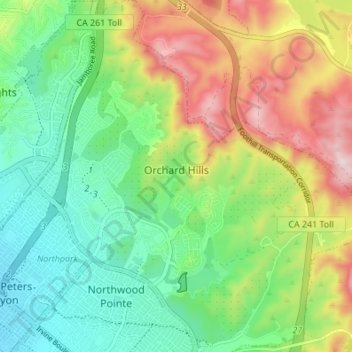
Name: Orchard Hills topographic map, elevation, terrain.
Location: Orchard Hills, Irvine, Orange County, California, USA (33.71707 -117.76691 33.77365 -117.70065)
Average elevation: 604 ft
Minimum elevation: 125 ft
Maximum elevation: 1,417 ft
Other topographic maps
Click on a map to view its topography, its elevation and its terrain.
Wildlife Sanctuary
USA > California > Irvine
Wildlife Sanctuary, 5, Westpark, Irvine, Orange County, California, 92612, USA
Average elevation: 49 ft