
Serra de Água topographic map
Interactive map
Click on the map to display elevation.
About this map
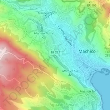
Name: Serra de Água topographic map, elevation, terrain.
Location: Serra de Água, Machico, Madeira, 9200-127, Portugal (32.71192 -16.78520 32.73192 -16.76520)
Average elevation: 679 ft
Minimum elevation: 0 ft
Maximum elevation: 1,942 ft
Other topographic maps
Click on a map to view its topography, its elevation and its terrain.
Pico da Coroa
Pico da Coroa, Machico, Madeira, 9300-083, Portugal
Average elevation: 1,010 ft