

Tingo María topographic map
Click on the map to display elevation.
Tingo María
Tingo María was considered unreachable until 1936, when the Montaña Road reached the settlement. It was then that the state run Estacion Experimental Agricola was established due to its "comfortable" elevation (2,204 ft). In 1942, the U.S. Government began adding more funding to the station, and by 1960 over 40,000 acres (160 km2) of land were under cultivation, especially along the Huallaga River valley where land was level. Coffee was a particularly valuable crop. The city nickname is "the Door of the Amazonia."
About this map
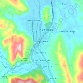
Name: Tingo María topographic map, elevation, terrain.
Average elevation: 2,654 ft
Minimum elevation: 2,057 ft
Maximum elevation: 4,829 ft