
Guggenberg topographic map
Interactive map
Click on the map to display elevation.
About this map
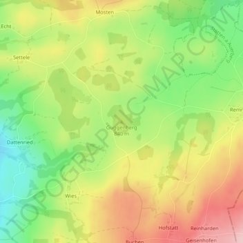
Name: Guggenberg topographic map, elevation, terrain.
Average elevation: 2,749 ft
Minimum elevation: 2,461 ft
Maximum elevation: 3,048 ft
Other topographic maps
Click on a map to view its topography, its elevation and its terrain.
Dattenried
Deutschland > Bayern > Landkreis Ostallgäu > Stötten a.Auerberg
Dattenried, Stötten a.Auerberg, Stötten a.Auerberg (VGem), Landkreis Ostallgäu, Bayern, 87675, Deutschland
Average elevation: 2,628 ft