
Noardburgum topographic map
Interactive map
Click on the map to display elevation.
About this map
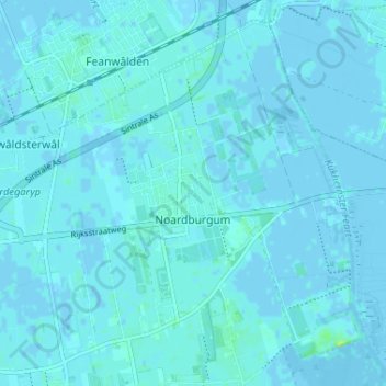
Name: Noardburgum topographic map, elevation, terrain.
Location: Noardburgum, Tietjerksteradeel, Friesland, Nederland (53.20653 5.96939 53.24125 6.03425)
Average elevation: 3 ft
Minimum elevation: -13 ft
Maximum elevation: 39 ft
Other topographic maps
Click on a map to view its topography, its elevation and its terrain.
Tietjerksteradeel
Nederland > Friesland > Tietjerksteradeel
Tietjerksteradeel, Friesland, Nederland
Average elevation: 0 ft