
Chaudenay topographic map
Interactive map
Click on the map to display elevation.
About this map
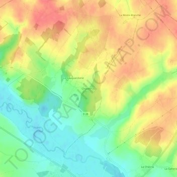
Name: Chaudenay topographic map, elevation, terrain.
Average elevation: 374 ft
Minimum elevation: 266 ft
Maximum elevation: 476 ft
Other topographic maps
Click on a map to view its topography, its elevation and its terrain.
Chaudenay
France > Centre-Val de Loire > Chaudenay
Chaudenay, Bourges, Cher, Centre-Val de Loire, France métropolitaine, France
Average elevation: 925 ft