
Furnas topographic map
Interactive map
Click on the map to display elevation.
About this map
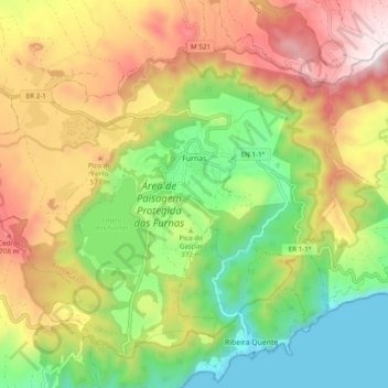
Name: Furnas topographic map, elevation, terrain.
Location: Furnas, Povoação, São Miguel, Açores, Portugal (37.73406 -25.37230 37.79687 -25.27597)
Average elevation: 1,273 ft
Minimum elevation: -7 ft
Maximum elevation: 2,871 ft