
Beargrass Creek topographic map
Interactive map
Click on the map to display elevation.
About this map
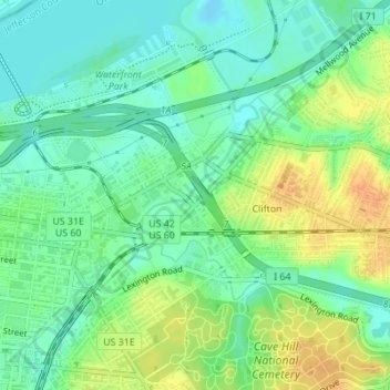
Name: Beargrass Creek topographic map, elevation, terrain.
Location: Beargrass Creek, Louisville, Jefferson County, Kentucky, USA (38.24524 -85.73499 38.26728 -85.71641)
Average elevation: 469 ft
Minimum elevation: 423 ft
Maximum elevation: 535 ft
Other topographic maps
Click on a map to view its topography, its elevation and its terrain.
Floyds Fork
USA > Kentucky > Louisville
Floyds Fork, Louisville, Jefferson County, Kentucky, 40023, USA
Average elevation: 627 ft