
San Rafael del Norte topographic map
Interactive map
Click on the map to display elevation.
About this map
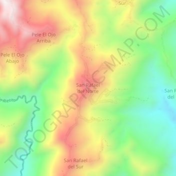
Name: San Rafael del Norte topographic map, elevation, terrain.
Average elevation: 2,927 ft
Minimum elevation: 1,640 ft
Maximum elevation: 4,439 ft
Other topographic maps
Click on a map to view its topography, its elevation and its terrain.
Guanare
Venezuela > Portuguesa State > Municipio Guanare
Guanare, Parroquia Capital Guanare, Municipio Guanare, Portuguesa State, Venezuela
Average elevation: 591 ft