
Bou Saâda topographic map
Interactive map
Click on the map to display elevation.
About this map
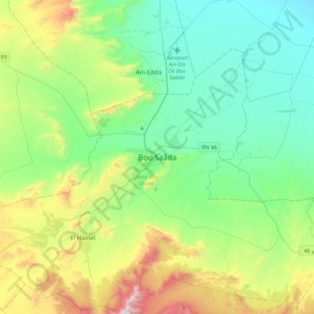
Name: Bou Saâda topographic map, elevation, terrain.
Location: Bou Saâda, Daïra Bou Sâada, M'Sila, 28200, Algérie (35.05331 4.02097 35.37331 4.34097)
Average elevation: 2,372 ft
Minimum elevation: 1,312 ft
Maximum elevation: 5,325 ft