
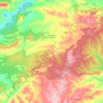
Las Parras de Castellote topographic map
Interactive map
Click on the map to display elevation.
About this map
Name: Las Parras de Castellote topographic map, elevation, terrain.
Location: Las Parras de Castellote, Bajo Aragón, Teruel, Aragón, España (40.71804 -0.28473 40.80624 -0.19408)
Average elevation: 2,480 ft
Minimum elevation: 1,667 ft
Maximum elevation: 3,176 ft