
Maresúa topographic map
Interactive map
Click on the map to display elevation.
About this map
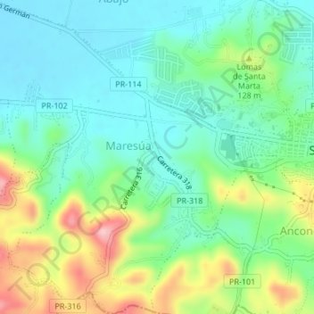
Name: Maresúa topographic map, elevation, terrain.
Location: Maresúa, San Germán, Puerto Rico, United States (18.06418 -67.08115 18.09612 -67.05044)
Average elevation: 262 ft
Minimum elevation: 79 ft
Maximum elevation: 669 ft
Other topographic maps
Click on a map to view its topography, its elevation and its terrain.
Rosario Peñón
United States > Puerto Rico > San Germán
Rosario Peñón, San Germán, Puerto Rico, United States
Average elevation: 492 ft
San Germán
United States > Puerto Rico > San Germán
San Germán, Puerto Rico, 00753, United States
Average elevation: 295 ft