
Kilosa topographic map
Interactive map
Click on the map to display elevation.
About this map
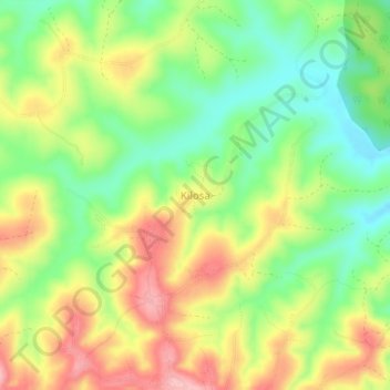
Name: Kilosa topographic map, elevation, terrain.
Average elevation: 5,292 ft
Minimum elevation: 5,059 ft
Maximum elevation: 5,571 ft
Other topographic maps
Click on a map to view its topography, its elevation and its terrain.
Iringa
Iringa, Iringa Region, Southern Highlands Zone, Tanzania
Average elevation: 3,986 ft
Isagwa
Tanzania > Iringa Region > Isagwa
Isagwa, Kilolo, Iringa Region, Southern Highlands Zone, Tanzania
Average elevation: 4,705 ft