
Lac Montigny topographic map
Interactive map
Click on the map to display elevation.
About this map
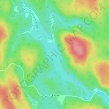
Name: Lac Montigny topographic map, elevation, terrain.
Average elevation: 1,004 ft
Minimum elevation: 869 ft
Maximum elevation: 1,211 ft
Other topographic maps
Click on a map to view its topography, its elevation and its terrain.
Lac Nominingue
Canada > Québec > Nominingue
Lac Nominingue, Chemin des Érables, Nominingue, Antoine-Labelle, Laurentides, Québec, Canada
Average elevation: 912 ft
Lac Gaumond
Canada > Québec > Nominingue
Lac Gaumond, Nominingue, Antoine-Labelle, Laurentides, Québec, Canada
Average elevation: 1,158 ft