
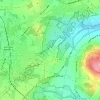
Horn-Bad Meinberg topographic map
Interactive map
Click on the map to display elevation.
About this map
Name: Horn-Bad Meinberg topographic map, elevation, terrain.
Average elevation: 696 ft
Minimum elevation: 561 ft
Maximum elevation: 961 ft
Other topographic maps
Click on a map to view its topography, its elevation and its terrain.
283
Germany > North Rhine-Westphalia > Horn-Bad Meinberg
283, Horn-Bad Meinberg, Kreis Lippe, Regierungsbezirk Detmold, North Rhine-Westphalia, 32805, Germany
Average elevation: 784 ft