
Hortontown topographic map
Interactive map
Click on the map to display elevation.
About this map
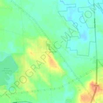
Name: Hortontown topographic map, elevation, terrain.
Location: Hortontown, Town of Lysander, Onondaga County, New York, USA (43.16868 -76.40438 43.20868 -76.36438)
Average elevation: 440 ft
Minimum elevation: 384 ft
Maximum elevation: 538 ft