
Lavelilla topographic map
Interactive map
Click on the map to display elevation.
About this map
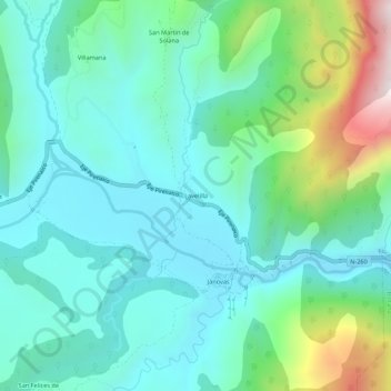
Name: Lavelilla topographic map, elevation, terrain.
Location: Lavelilla, Fiscal, Sobrarbe, Huesca, Aragon, Espagne (42.45404 -0.02604 42.49404 0.01396)
Average elevation: 2,792 ft
Minimum elevation: 2,070 ft
Maximum elevation: 5,253 ft