
Thank you for supporting this site ❤️
Make a donation
Make a donation
Gear up for your next adventure:
As an Amazon Associate, this site earns from qualifying purchases at no extra cost to you.
Savognin topographic map
Click on the map to display elevation.
Thank you for supporting this site ❤️
Make a donation
Make a donation
Gear up for your next adventure:
As an Amazon Associate, this site earns from qualifying purchases at no extra cost to you.
About this map
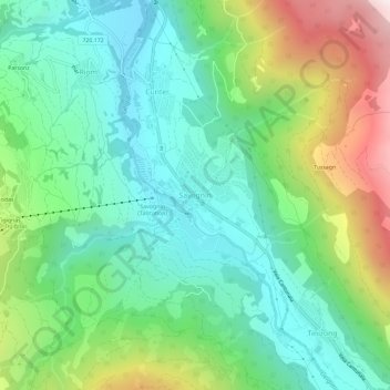
Name: Savognin topographic map, elevation, terrain.
Location: Savognin, Surses, Albula, Grisons, 7460, Switzerland (46.57696 9.57815 46.61696 9.61815)
Average elevation: 4,793 ft
Minimum elevation: 3,675 ft
Maximum elevation: 7,270 ft
Thank you for supporting this site ❤️
Make a donation
Make a donation
Gear up for your next adventure:
As an Amazon Associate, this site earns from qualifying purchases at no extra cost to you.