
Orsa topographic map
Interactive map
Click on the map to display elevation.
About this map
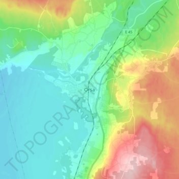
Name: Orsa topographic map, elevation, terrain.
Location: Orsa, Comté de Dalécarlie, Svealand, 79421, Suède (61.08012 14.58225 61.16012 14.66225)
Average elevation: 689 ft
Minimum elevation: 499 ft
Maximum elevation: 1,142 ft