Geolocate

Kakching topographic map

Click on the map to display elevation.

About this map

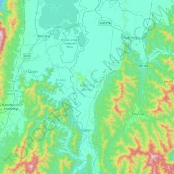
Name: Kakching topographic map, elevation, terrain.

Location: Kakching, Manipur, India (24.20008 93.83808 24.57776 94.05353)

Average elevation: 3,035 ft

Minimum elevation: 2,306 ft

Maximum elevation: 6,224 ft

Gear up for your next adventure:

☀️Outdoor Sunscreen - High protection sunscreen for outdoor activities
🎒Trail Energy Bars - High‑calorie bars for hiking energy
🌐World Map Poster - Decorative world maps with topographic info
🧢Outdoor Hiking Hat - Sun protection hat for outdoor explorers
📷Action Cameras - Rugged cameras to document your journeys across rugged terrain

As an Amazon Associate, this site earns from qualifying purchases at no extra cost to you.