
Wicklow topographic map
Interactive map
Click on the map to display elevation.
About this map
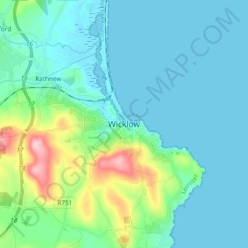
Name: Wicklow topographic map, elevation, terrain.
Location: Wicklow, County Wicklow, Leinster, A67 HD86, Ireland (52.94024 -6.08142 53.02024 -6.00142)
Average elevation: 112 ft
Minimum elevation: -7 ft
Maximum elevation: 636 ft