
Schwarzhorn topographic map
Interactive map
Click on the map to display elevation.
About this map
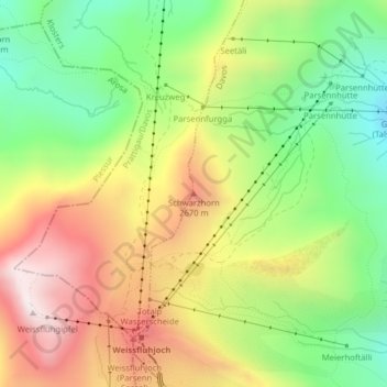
Name: Schwarzhorn topographic map, elevation, terrain.
Location: Schwarzhorn, Davos, Prättigau/Davos, Grigioni, 7265, Svizzera (46.84289 9.81112 46.84299 9.81122)
Average elevation: 7,881 ft
Minimum elevation: 6,690 ft
Maximum elevation: 9,291 ft
Other topographic maps
Click on a map to view its topography, its elevation and its terrain.