
Jauchsdorf topographic map
Interactive map
Click on the map to display elevation.
About this map
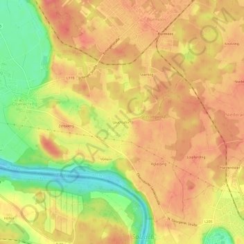
Name: Jauchsdorf topographic map, elevation, terrain.
Average elevation: 1,398 ft
Minimum elevation: 1,253 ft
Maximum elevation: 1,480 ft
Other topographic maps
Click on a map to view its topography, its elevation and its terrain.
Au
Österreich > Salzburg > Bezirk Salzburg-Umgebung > Sankt Georgen bei Salzburg
Au, Sankt Georgen bei Salzburg, Bezirk Salzburg-Umgebung, Salzburg, 5113, Österreich
Average elevation: 1,339 ft