
Thal topographic map
Interactive map
Click on the map to display elevation.
About this map
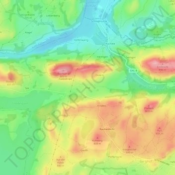
Name: Thal topographic map, elevation, terrain.
Location: Thal, Landkreis Ostallgäu, Souabe, Bavière, 87642, Allemagne (47.62598 10.75959 47.66598 10.79959)
Average elevation: 2,618 ft
Minimum elevation: 2,411 ft
Maximum elevation: 2,890 ft