
Bouzeguène topographic map
Interactive map
Click on the map to display elevation.
About this map
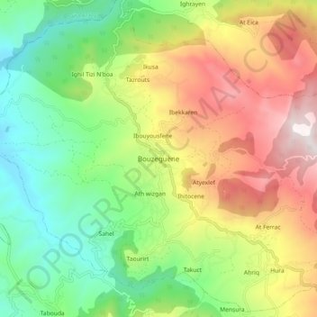
Name: Bouzeguène topographic map, elevation, terrain.
Location: Bouzeguène, Daïra Bouzguen, Tizi Ouzou, Algérie (36.57792 4.43615 36.65792 4.51615)
Average elevation: 2,457 ft
Minimum elevation: 850 ft
Maximum elevation: 4,767 ft