
Lincolnville topographic map
Interactive map
Click on the map to display elevation.
About this map
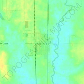
Name: Lincolnville topographic map, elevation, terrain.
Location: Lincolnville, Marion County, Kansas, 66858, United States (38.48997 -96.96709 38.49774 -96.95649)
Average elevation: 1,427 ft
Minimum elevation: 1,394 ft
Maximum elevation: 1,467 ft
Other topographic maps
Click on a map to view its topography, its elevation and its terrain.
Lost Springs
United States > Kansas > Marion County
Lost Springs, Marion County, Kansas, United States
Average elevation: 1,476 ft
Burns
United States > Kansas > Marion County
Burns, Marion County, Kansas, United States
Average elevation: 1,493 ft
Ramona
United States > Kansas > Marion County
Ramona, Marion County, Kansas, 67475, United States
Average elevation: 1,427 ft