
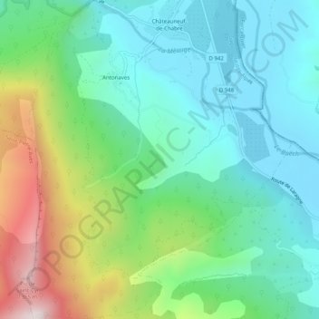
Antonaves topographic map
Interactive map
Click on the map to display elevation.
About this map
Name: Antonaves topographic map, elevation, terrain.
Average elevation: 2,493 ft
Minimum elevation: 1,683 ft
Maximum elevation: 4,537 ft
Other topographic maps
Click on a map to view its topography, its elevation and its terrain.
Ribiers
France > Provence-Alpes-Côte d'Azur > Hautes-Alpes > Val-Buëch-Méouge
Ribiers, Val-Buëch-Méouge, Gap, Hautes-Alpes, Provence-Alpes-Côte d'Azur, France métropolitaine, 05300, France
Average elevation: 2,585 ft