
Döbern topographic map
Interactive map
Click on the map to display elevation.
About this map
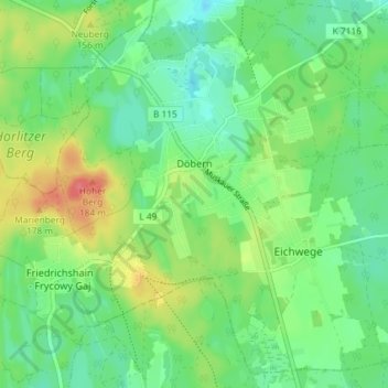
Name: Döbern topographic map, elevation, terrain.
Location: Döbern, Döbern-Land, Spree-Neiße, Brandenburg, 03159, Germany (51.59008 14.57134 51.63209 14.64429)
Average elevation: 463 ft
Minimum elevation: 390 ft
Maximum elevation: 591 ft