
Chignolo d'Isola topographic map
Interactive map
Click on the map to display elevation.
About this map
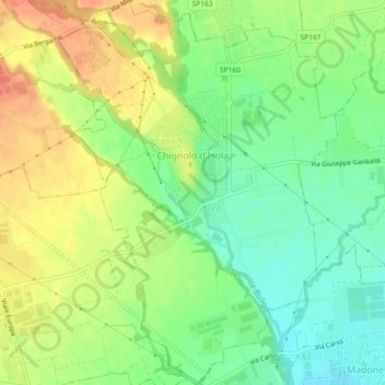
Name: Chignolo d'Isola topographic map, elevation, terrain.
Location: Chignolo d'Isola, BG, Lombardy, Italy (45.64867 9.51180 45.68029 9.54542)
Average elevation: 728 ft
Minimum elevation: 653 ft
Maximum elevation: 814 ft