
Jatumpampa topographic map
Interactive map
Click on the map to display elevation.
About this map
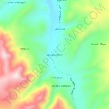
Name: Jatumpampa topographic map, elevation, terrain.
Location: Jatumpampa, General Sánchez Cerro, Moquegua, Perú (-16.29626 -70.46915 -16.25626 -70.42915)
Average elevation: 14,183 ft
Minimum elevation: 13,540 ft
Maximum elevation: 15,249 ft