
Oberviechtach topographic map
Interactive map
Click on the map to display elevation.
About this map
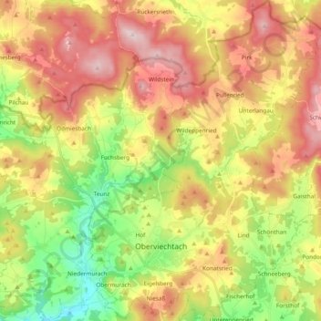
Name: Oberviechtach topographic map, elevation, terrain.
Location: Oberviechtach, Landkreis Schwandorf, Bavière, 92526, Allemagne (49.43162 12.37654 49.55380 12.51418)
Average elevation: 1,900 ft
Minimum elevation: 1,319 ft
Maximum elevation: 2,513 ft
Other topographic maps
Click on a map to view its topography, its elevation and its terrain.