
Großerlach topographic map
Interactive map
Click on the map to display elevation.
About this map
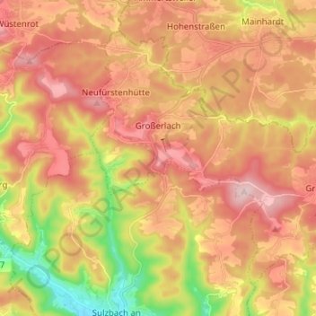
Name: Großerlach topographic map, elevation, terrain.
Average elevation: 1,503 ft
Minimum elevation: 873 ft
Maximum elevation: 1,978 ft
Other topographic maps
Click on a map to view its topography, its elevation and its terrain.
Kirchberg an der Murr
Duitsland > Baden-Württemberg > Rems-Murr-Kreis
Kirchberg an der Murr, Vereinbarte Verwaltungsgemeinschaft der Stadt Backnang, Rems-Murr-Kreis, Baden-Württemberg, 71737, Duitsland
Average elevation: 945 ft
Waiblingen
Duitsland > Baden-Württemberg > Rems-Murr-Kreis
Waiblingen, Remshalden, Rems-Murr-Kreis, Baden-Württemberg, Duitsland
Average elevation: 935 ft