
Nahunta topographic map
Interactive map
Click on the map to display elevation.
About this map
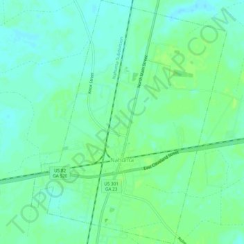
Name: Nahunta topographic map, elevation, terrain.
Location: Nahunta, Brantley County, Georgia, 31553, United States (31.19046 -81.99893 31.23099 -81.96082)
Average elevation: 62 ft
Minimum elevation: 43 ft
Maximum elevation: 75 ft
Other topographic maps
Click on a map to view its topography, its elevation and its terrain.
Waynesville
United States > Georgia > Brantley County
Waynesville, Brantley County, Georgia, United States
Average elevation: 56 ft
Hoboken
United States > Georgia > Brantley County
Hoboken, Brantley County, Georgia, 31542, United States
Average elevation: 121 ft
Hortense
United States > Georgia > Brantley County > Hortense
Hortense, Brantley County, Georgia, United States
Average elevation: 52 ft