
Tacheng topographic map
Interactive map
Click on the map to display elevation.
About this map
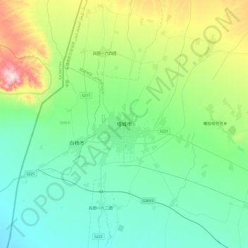
Name: Tacheng topographic map, elevation, terrain.
Location: Tacheng, Tacheng City, Tacheng Prefecture, Xinjiang, China (46.59103 82.82383 46.91103 83.14383)
Average elevation: 2,001 ft
Minimum elevation: 1,388 ft
Maximum elevation: 4,154 ft