Geolocate

Newcastle topographic map

Click on the map to display elevation.

About this map

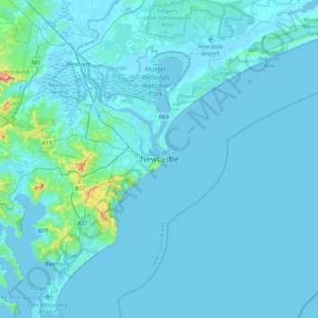
Name: Newcastle topographic map, elevation, terrain.

Location: Newcastle, Newcastle-Maitland, City of Newcastle, New South Wales, 2300, Australia (-33.08729 151.62125 -32.76729 151.94125)

Average elevation: 30 ft

Minimum elevation: -13 ft

Maximum elevation: 669 ft

Other topographic maps

Click on a map to view its topography, its elevation and its terrain.

Sydney

Australia > New South Wales

Sydney's topography is characterized by a diverse landscape that seamlessly blends coastal features with inland plateaus. The city is divided into two primary regions: the relatively flat Cumberland Plain to the south and west of Sydney Harbour, and the elevated Hornsby Plateau to the north. The Cumberland…

Average elevation: 174 ft

Bowral

Australia > New South Wales

Average elevation: 2,264 ft

Sydney

Australia > New South Wales > Sydney

Average elevation: 75 ft

Newcastle

Australia > New South Wales

Average elevation: 16 ft

Baulkham Hills

Australia > New South Wales

Average elevation: 305 ft

Central Coast Council

Australia > New South Wales

Average elevation: 338 ft

Armidale

Australia > New South Wales

Average elevation: 3,399 ft

Mosman

Australia > New South Wales > Sydney

Average elevation: 95 ft

Katoomba

Australia > New South Wales

Average elevation: 2,966 ft

Banksmeadow

Australia > New South Wales > Sydney

Average elevation: 33 ft

Trunkey Creek

Australia > New South Wales

Average elevation: 2,844 ft

Grafton

Australia > New South Wales

Average elevation: 16 ft

Mudgee

Australia > New South Wales

Average elevation: 1,755 ft

Kingswood

Australia > New South Wales > Sydney > Penrith

Average elevation: 174 ft

Mullumbimby

Australia > New South Wales

Average elevation: 95 ft

Cowra Shire Council

Australia > New South Wales

Average elevation: 1,545 ft

Tintenbar

Australia > New South Wales

Average elevation: 161 ft

Braidwood

Australia > New South Wales

Average elevation: 2,211 ft

Northern Beaches

Australia > New South Wales > Sydney

Average elevation: 220 ft

Fingal Head

Australia > New South Wales

Average elevation: 13 ft

Olney

Australia > New South Wales

Average elevation: 741 ft

Yass

Australia > New South Wales

Yass is located 280 km south-west of Sydney, on the Hume Highway. The Yass River, which is a tributary of the Murrumbidgee River, flows through the town. Yass is 59 km from Canberra; lying at an elevation of 505 m AMSL.

Average elevation: 1,749 ft

Goulburn

Australia > New South Wales

Owing to its elevation, Goulburn has an oceanic climate (Cfb) with warm summers and cool winters; with a high diurnal range. Its climate is variable much of the year, though generally dry with maximum temperatures ranging from 11.8 °C (53.2 °F) in July to 28.3 °C (82.9 °F) in January. Rainfall is…

Average elevation: 2,185 ft

Byron Bay

Australia > New South Wales

Byron Bay, located in northeastern New South Wales, Australia, is characterized by diverse topography shaped by its geological history. The town is part of the erosion caldera of the ancient Tweed Volcano, which erupted approximately 23 million years ago, resulting in the rich volcanic soils that define the…

Average elevation: 23 ft

North Sydney

Australia > New South Wales > Sydney

Average elevation: 164 ft

Malabar

Australia > New South Wales

Average elevation: 79 ft

Manyana

Australia > New South Wales

Average elevation: 56 ft

South Murwillumbah

Australia > New South Wales

Average elevation: 26 ft

Werris Creek

Australia > New South Wales

Average elevation: 1,470 ft

Cangai

Australia > New South Wales

Average elevation: 1,122 ft

Bulahdelah

Australia > New South Wales

Average elevation: 341 ft

Ganmain

Australia > New South Wales

Average elevation: 659 ft

Nimbin

Australia > New South Wales

Average elevation: 771 ft

Ryde

Australia > New South Wales > Sydney

Average elevation: 171 ft

Mount Warrigal

Australia > New South Wales

The suburb includes "Native Dog Hill" and its surrounding areas. To the north and west are the shores of Lake Illawarra. With its high elevation above the surrounding areas and close proximity to the lake, the suburb has excellent views of the Pacific Ocean to the east, Lake Illawarra and the Illawarra…

Average elevation: 39 ft

Carlingford

Australia > New South Wales > Sydney

Average elevation: 322 ft

Rozelle

Australia > New South Wales > Sydney

Average elevation: 52 ft

Nowra

Australia > New South Wales

Average elevation: 69 ft

Windsor

Australia > New South Wales > Sydney

Average elevation: 39 ft

Glenfield

Australia > New South Wales > Sydney

Average elevation: 95 ft

Camperdown

Australia > New South Wales > Sydney

Average elevation: 85 ft

Parkes Shire Council

Australia > New South Wales

Average elevation: 1,007 ft

Bullocks Flat

Australia > New South Wales

Average elevation: 3,927 ft

Hurlstone Park

Australia > New South Wales > Sydney

Average elevation: 79 ft

Blue Mountains

Australia > New South Wales

A sandstone plateau dominated by a landscape of endless eucalyptus forests, the Blue Mountains are located at the top of a 470-million-year-old quartzite. In the Permian period, a shallow sea covered the region, when rivers brought shales, siltstones and mudstones. Then during the Mesozoic period, rivers…

Average elevation: 1,857 ft

Bilambil Heights

Australia > New South Wales

Average elevation: 135 ft

Ebenezer

Australia > New South Wales > Sydney

Average elevation: 82 ft

Jamison Valley

Australia > New South Wales > Sydney > Leura

South of Mount Solitary, the valley sprawls through Cedar and Kedumba Valley down to Coxs River and Lake Burragorang, the lake that was created when Warragamba Dam was built. There is a 3 kilometres (1.9 mi) prohibited area around the river and lake to protect Sydney's water supply. Around this area there is a…

Average elevation: 1,896 ft

Mount Victoria

Australia > New South Wales

Mount Victoria (postcode: 2786) is a small township in the Blue Mountains of New South Wales, Australia. Mount Victoria is geographically the western most village and suburb of Greater Sydney on the great western highway in the City of Blue Mountains, located about 120 kilometres (75 mi) west-northwest by road…

Average elevation: 2,956 ft

Shoalhaven Heads

Australia > New South Wales

Average elevation: 16 ft

Capertee

Australia > New South Wales

Average elevation: 2,484 ft

Campbelltown

Australia > New South Wales

Average elevation: 315 ft

Five Dock

Australia > New South Wales

Average elevation: 39 ft

Lithgow City Council

Australia > New South Wales

Average elevation: 2,339 ft

Little Hartley

Australia > New South Wales

Average elevation: 2,592 ft

Glen Innes

Australia > New South Wales

Average elevation: 3,553 ft

Pittwater

Australia > New South Wales

Average elevation: 148 ft

Emmaville

Australia > New South Wales

Emmaville is at an elevation of 890 metres AHD. At the 2006 census, the Emmaville "urban centre/locality" had a population of 247 (in the 2001 census it was 303) and there were 535 persons usually resident in the Emmaville region.

Average elevation: 2,818 ft

Edmondson Park

Australia > New South Wales > Sydney

Average elevation: 184 ft

Waverley Council

Australia > New South Wales

Average elevation: 75 ft

Keerrong

Australia > New South Wales

Average elevation: 302 ft

New England National Park

Australia > New South Wales

The park lies within the Eastern Australian temperate forests ecoregion. It is noted for the wide variety of plant and animal species. The diverse vegetation in the park includes sub-tropical, warm temperate and cool temperate rainforest in the higher altitudes. There are also areas of sclerophyll forest,…

Average elevation: 1,834 ft

Bilgola Plateau

Australia > New South Wales

The suburb is mainly residential, with two small rows of shops, a small park and a primary school located on the top of the plateau. Bilgola Beach on the eastern side features a surf club and kiosk. Rising to an elevation of 150m above sea level, the suburb has views of the beach and the ocean on the eastern…

Average elevation: 121 ft

Molong

Australia > New South Wales

Average elevation: 1,952 ft

Nana Glen

Australia > New South Wales

Average elevation: 459 ft

Gundaroo

Australia > New South Wales

Average elevation: 2,198 ft

Cargo

Australia > New South Wales

Average elevation: 1,768 ft

Warialda

Australia > New South Wales

Average elevation: 1,378 ft

Deniliquin

Australia > New South Wales

Average elevation: 308 ft

Hovells Creek

Australia > New South Wales

Average elevation: 1,486 ft

Tuntable Creek

Australia > New South Wales

Average elevation: 561 ft

Wyanbene

Australia > New South Wales

Average elevation: 2,310 ft

Colo Heights

Australia > New South Wales

Average elevation: 912 ft

Griffith City Council

Australia > New South Wales

Average elevation: 440 ft

Singleton Council

Australia > New South Wales

Average elevation: 781 ft

Port Macquarie

Australia > New South Wales

Average elevation: 16 ft

Lismore City Council

Australia > New South Wales

Average elevation: 272 ft

Mittagong

Australia > New South Wales

Average elevation: 2,205 ft

Orange

Australia > New South Wales

Orange is a city in the Central Tablelands region of New South Wales, Australia. It is 254 km (158 mi) west of the state capital, Sydney [206 km (128 mi) on a great circle], at an altitude of 862 metres (2,828 ft). Orange had an estimated urban population of 40,493 as of June 2018 making the city a significant…

Average elevation: 2,795 ft

Lismore

Australia > New South Wales

Average elevation: 75 ft

Portland

Australia > New South Wales

At an altitude of 925 metres above sea level, Portland is the 21st highest town in Australia and classified as a temperate zone. Cool winters and warm summers ensure four distinct seasons and snowfalls each winter.

Average elevation: 3,189 ft

Maitland

Australia > New South Wales

Average elevation: 36 ft

River Lett

Australia > New South Wales

Average elevation: 2,638 ft

Horsley Park

Australia > New South Wales

Average elevation: 259 ft

Goobarragandra

Australia > New South Wales

Average elevation: 2,877 ft

Morton

Australia > New South Wales

Average elevation: 295 ft

Cooranbong

Australia > New South Wales

Average elevation: 236 ft

Killarney Vale

Australia > New South Wales

Average elevation: 26 ft

Parramatta

Australia > New South Wales

Average elevation: 72 ft

Gear up for your next adventure:

🥇GPS Hiking Watch - Multi‑sport GPS watch with navigation and trail tracking
🪶Survival Guide Book - Expert advice for emergency preparedness
🌄Hiking Binoculars - Compact binoculars for scenic views and trail spotting
🌐World Map Poster - Decorative world maps with topographic info
🥾Men's Hiking Boots - Durable, waterproof footwear for rugged terrain and steep inclines

As an Amazon Associate, this site earns from qualifying purchases at no extra cost to you.