
鹹田 Ham Tin topographic map
Interactive map
Click on the map to display elevation.
About this map
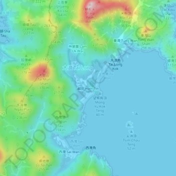
Name: 鹹田 Ham Tin topographic map, elevation, terrain.
Location: 鹹田 Ham Tin, 西貢區 Sai Kung District, HK, RPC (22.39160 114.35570 22.43160 114.39570)
Average elevation: 256 ft
Minimum elevation: -13 ft
Maximum elevation: 1,371 ft