
Chlef topographic map
Interactive map
Click on the map to display elevation.
About this map
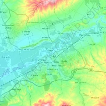
Name: Chlef topographic map, elevation, terrain.
Location: Chlef, daïra Chlef, Chlef, RADP (36.09029 1.25950 36.24885 1.44872)
Average elevation: 587 ft
Minimum elevation: 249 ft
Maximum elevation: 1,713 ft