
Olivetta topographic map
Interactive map
Click on the map to display elevation.
About this map
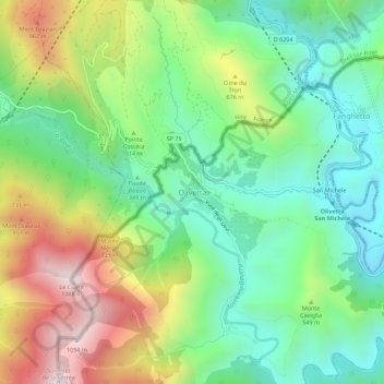
Name: Olivetta topographic map, elevation, terrain.
Location: Olivetta, Imperia, Ligurie, Italie (43.85954 7.49482 43.89954 7.53482)
Average elevation: 1,512 ft
Minimum elevation: 328 ft
Maximum elevation: 3,593 ft