
Tres de Mayo topographic map
Interactive map
Click on the map to display elevation.
About this map
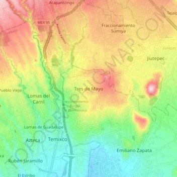
Name: Tres de Mayo topographic map, elevation, terrain.
Location: Tres de Mayo, Emiliano Zapata, Morelos, 62760, México (18.82781 -99.24878 18.90781 -99.16878)
Average elevation: 4,390 ft
Minimum elevation: 3,944 ft
Maximum elevation: 4,980 ft
Other topographic maps
Click on a map to view its topography, its elevation and its terrain.
Tezoyuca
México > Morelos > Emiliano Zapata
Tezoyuca, Emiliano Zapata, Morelos, 62790, México
Average elevation: 3,953 ft