
Linge topographic map
Interactive map
Click on the map to display elevation.
About this map
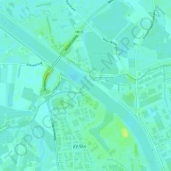
Name: Linge topographic map, elevation, terrain.
Location: Linge, Tiel, Gelderland, Nederland, 4011LX, Nederland (51.91872 5.43332 51.92041 5.43569)
Average elevation: 16 ft
Minimum elevation: 3 ft
Maximum elevation: 56 ft
Other topographic maps
Click on a map to view its topography, its elevation and its terrain.
Kerk Avezaath
Nederland > Gelderland > Tiel
Kerk Avezaath, Tiel, Gelderland, Nederland
Average elevation: 20 ft
Wadenoijen
Nederland > Gelderland > Tiel
Wadenoijen, Tiel, Gelderland, Nederland
Average elevation: 13 ft
Dode Linge
Nederland > Gelderland > Tiel
Dode Linge, Rivierenlandlaan, Westroijen, Tiel, Gelderland, Nederland, 4003JK, Nederland
Average elevation: 20 ft
Zennewijnen
Nederland > Gelderland > Tiel > Zennewijnen
Zennewijnen, Tiel, Gelderland, Nederland
Average elevation: 20 ft
Kapel Avezaath
Nederland > Gelderland > Tiel
Kapel Avezaath, Tiel, Gelderland, Nederland
Average elevation: 16 ft