
Hadera topographic map
Interactive map
Click on the map to display elevation.
About this map
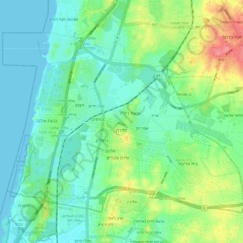
Name: Hadera topographic map, elevation, terrain.
Location: Hadera, Hadera Subdistrict, Haifa District, Israel (32.40340 34.86235 32.47816 34.97861)
Average elevation: 69 ft
Minimum elevation: 0 ft
Maximum elevation: 243 ft