
Slagelse topographic map
Interactive map
Click on the map to display elevation.
About this map
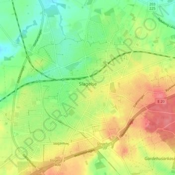
Name: Slagelse topographic map, elevation, terrain.
Location: Slagelse, Slagelse Municipality, Region Zealand, 4200, Denmark (55.38496 11.31836 55.42509 11.40230)
Average elevation: 144 ft
Minimum elevation: 39 ft
Maximum elevation: 266 ft
Other topographic maps
Click on a map to view its topography, its elevation and its terrain.
Slagelse
Denmark > Region Zealand > Slagelse
Slagelse, Slagelse Municipality, Region Zealand, Denmark
Average elevation: 154 ft